What you can see on the A Guarda webcam
The camera stands on Santa Trega and turns between several views: the harbour and the town directly below, the farmland of the O Rosal valley inland, and the mouth of the Miño with the Portuguese town of Caminha on the far bank. A 24-hour time-lapse of the same camera follows the live picture.
From Santa Trega: the harbour, the estuary and Portugal
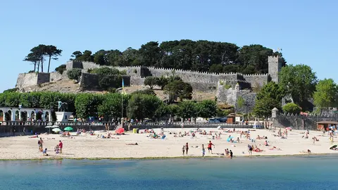
This camera stands on Monte Santa Trega, the hill of about 340 m (1,100 ft) at the south-western corner of Galicia, and it turns through a sequence of views. Straight down lies A Guarda: the harbour basin with its breakwaters, the tight grid of houses climbing from the waterfront and the rocky coast running north into the haze. Swung inland, it looks over the farmland and villages of the O Rosal valley; turned south, it shows the wide mouth of the Miño, its sandbanks and marshes, and the Portuguese shore around Caminha, with mountains behind.
The views are long and change with the haze: on a clear day you can follow the coast for miles in both countries. The fishing boats in the harbour, the tide on the estuary sands and the cloud on the Portuguese mountains are all there to read.
An Iron Age town on the hill
The slopes of Santa Trega are covered in the stone foundations of a castro, a hill fort of the Iron Age culture of north-west Iberia, one of the most visited in Galicia. Dozens of round houses huddle inside its walls, and a couple have been rebuilt with thatched conical roofs to show how they looked. A small archaeological museum and a chapel stand near the summit, at about 340 m (1,100 ft). For walkers, A Guarda is also where the coastal branch of the Portuguese Way crosses into Spain from Caminha.
When to watch A Guarda
A Guarda is one hour ahead of the UK and Ireland, while Portugal, across the river, keeps the same time as the UK: the clock jumps an hour as you cross the border. The views from Santa Trega are at their longest on clear days after rain, when the Portuguese mountains stand out sharply; summer haze and sea mist can cut the view to a few miles. Sunsets here are over the open Atlantic, and the harbour comes alive when the boats return.
Around A Guarda
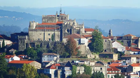
North along the coast road, the Cistercian monastery of Oia stands right at the edge of the sea, and Baiona lies beyond. Inland, Tui faces Portugal across the Miño about 18 miles (28 km) upstream. Across the estuary, Caminha and the beaches of northern Portugal are a short drive away over the river bridges.
Getting to A Guarda
The most convenient airport for British and Irish visitors is often Porto, in Portugal, about 65 miles (105 km) south by motorway; Santiago de Compostela is further, at about 100 miles (160 km). A road climbs almost to the summit of Santa Trega, and a footpath winds up through the woods from the town.