What you can see on the Agaete webcams
There are three live cameras in the town. The first looks along the dark pebble beach of Las Nieves to the towering cliffs of the west coast; the second looks across the harbour, over the fishing boats and yachts, to the long quay where the ferries berth; the third, from a rooftop, faces the mountains around the valley. Two of them can also be replayed as a 24-hour time-lapse. Together they answer the question every visitor from the south asks before setting off: is the north clear today, or wrapped in cloud?
Las Nieves beach and the cliffs of the west coast
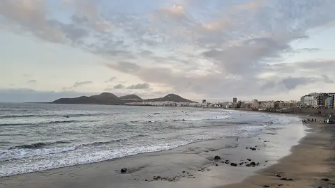
From the seafront of Puerto de las Nieves, this live camera looks south-west along the curve of Las Nieves beach, a strip of dark pebbles and sand, to the cliffs of the west coast, which fall almost sheer into the sea. The quay and its walkway run along the right edge of the picture, and the afternoon sun shines straight towards the lens.
It shows at once whether the cliff tops are in cloud, how much swell is breaking on the shore and how the light is changing for the evening. Windy lists the camera as "Dedo de Dios", after the rock pillar at the foot of those cliffs, and its 24-hour time-lapse follows it on this page.
The Tenerife ferry quay at Puerto de las Nieves
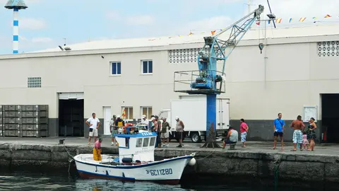
This live camera looks across the harbour of Puerto de las Nieves. In front, a shingle shore and a few dark volcanic rocks lead down to the water; in the middle, fishing boats and yachts lie at their moorings inside the breakwater; behind them runs the long quay where the ferries to Tenerife berth, with the great cliffs of the west coast rising on the left.
It is the camera to look at before a crossing, for the state of the sea and the wind on the water, and late in the day it shows the cliffs turning gold in the low sun.
Agaete's mountains and the sky over the valley
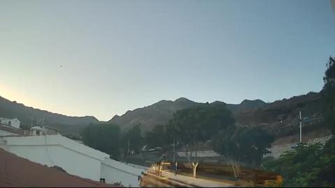
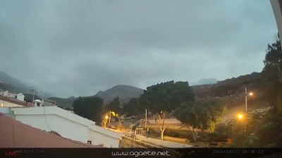
From a rooftop in the town, this live camera looks over white walls and tiled roofs, past a street lined with trees and lamp posts, towards the mountains that enclose the valley of Agaete. Most of the picture is sky, which makes it a cloud camera: on many mornings the trade-wind cloud sits on the ridges, while on clear days the bare, rocky summits stand sharp against the blue.
Check it before deciding whether to head up the valley for a walk or stay by the sea. A 24-hour time-lapse of the same view follows it on this page.
Sunshine in the south, cloud in the north?
Gran Canaria's weather is shaped by the trade wind, which blows from the north-east for much of the year and piles cloud against the northern slopes. The south stays sunny while the north can be grey, so it pays to look before driving over. When the north-west is clear, though, the scenery is spectacular, with cliffs hundreds of metres high glowing in the afternoon sun. Below them stood the Dedo de Dios, "God's Finger", a slender rock pillar that lost its top to Tropical Storm Delta in November 2005.
When to watch Agaete
The Canary Islands keep the same time as the UK and Ireland, so the clock on the cameras is the clock at home. The beach and the harbour face west and south-west, which makes the late afternoon the best time to look; mornings are more often cloudy. In winter, Atlantic swells break hard on this coast, while summer usually brings a calmer sea.
Around Agaete
Las Salinas, a set of natural pools in the volcanic rock beside the harbour, built where salt pans once stood, are where most visitors swim. The valley of Agaete climbs inland past fruit farms and some of the few coffee plantations in Europe, and the pine forest of Tamadaba Natural Park crowns the mountains above.
Visiting Agaete
Gran Canaria airport is about 35 miles (56 km) away, and Maspalomas about 54 miles (87 km), roughly an hour and a quarter by motorway. Ferries cross from the harbour to Santa Cruz de Tenerife in about 80 minutes, which makes Agaete an easy start for a two-island holiday.