What you can see on the Maspalomas webcams
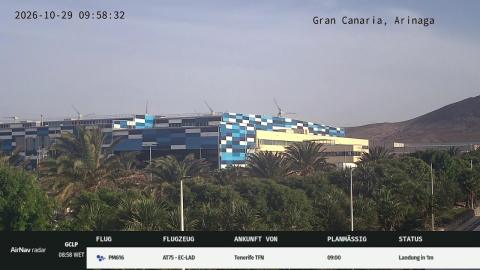
The cameras cover the dunes from their eastern edge, the long beach and La Charca, the small lagoon at the western end near the lighthouse. One live view looks south across the sand hills to the sea; another runs along the beach from the lagoon. A third camera roams the coast, from the lighthouse and the promenade at Meloneras to the wind turbines of Arinaga and the mountains inland. Two of the views also come as 24-hour time-lapses, handy for seeing how the day's weather developed.
Maspalomas dunes webcam from the Santa Mónica hotel
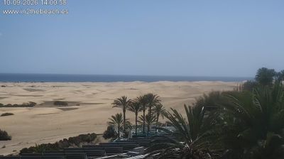
This live camera is mounted on the Santa Mónica Suites Hotel, on the eastern edge of the Maspalomas dunes where Playa del Inglés ends, and it looks south across the reserve. A fisheye lens takes in almost the whole sweep: rippled sand and low scrub in the foreground, the hotel's palms and terraces on the right, and the Atlantic running along the horizon.
The sun rises on the left of the frame, so the first hour or two can be bright and hazy; from late morning the colours of the sand settle. It is the quickest way to see whether the trade wind is lifting sand off the crests before you set out across the dunes, and whether the sky over the south of the island is clear.
La Charca lagoon and Maspalomas beach
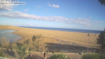
Set on a terrace beside La Charca, the brackish lagoon at the western end of Maspalomas beach, this camera looks east along the sand. On the left lies the still water of the lagoon inside a curve of pale sand; in the middle, the fenced edge of the dunes and the wide beach; on the right, the open sea.
In the morning it faces almost straight into the sunrise, which turns the whole scene silver. Later the light comes from behind and the colours return. Watch it to count the walkers along the shoreline, to see whether the sea is flat or breaking, and to check on the lagoon itself, a resting place for birds in the middle of the resort. It plays as a time-lapse of the last 24 hours.
A roving webcam along the Maspalomas coast
Unlike the fixed cameras on this page, this one moves. Its owner pans it along the south of Gran Canaria, so in one session you may see the Maspalomas lighthouse, the promenade and hotels of Meloneras, the dunes and, further east, the flat coast and wind turbines around Arinaga with the mountains behind. A flight-tracking panel sometimes shares the screen, showing aircraft on their way into Gran Canaria airport.
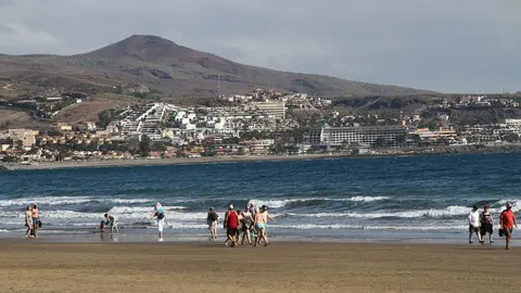
Because the view keeps changing, it is less useful for watching a single beach than for a general read of the weather along the whole coast: how much cloud is sitting on the mountains, how clear the air is, and whether the sea beyond the lighthouse is calm.
The dunes and the lighthouse
The Maspalomas Dunes cover about 400 hectares (990 acres) and have been a protected nature reserve since 1987. The sand was left exposed when sea levels fell during the last ice age and has been blown towards the coast ever since, so the ridges shift a little every year. At the western end stands the Faro de Maspalomas, built between 1884 and 1889; at 56 metres (184 ft) it is the tallest masonry lighthouse in the Canary Islands, and its light carries 19 nautical miles out to sea.
When to watch Maspalomas
Early morning and late afternoon, when low sun picks out the ripples on the dunes. Winter is when most visitors come: daytime temperatures usually sit in the low to mid 20s °C and the sea stays at around 19°C or more. In midwinter the sun rises at about 8am and sets a little after 6pm. The north-east trade wind blows hardest in summer and often lifts sand off the crests in the afternoon.
Around Maspalomas
Meloneras, with its promenade and hotels, lies just west of the lighthouse. To the east, Playa del Inglés and San Agustín continue the coast. Inland, the GC-60 road climbs the Fataga ravine into the mountains of the island's centre.
Visiting Maspalomas
Gran Canaria airport is about 20 miles (around 30 km) away along the GC-1 motorway. Inside the reserve, keep to the marked paths: the plants that hold the sand in place are fragile. There is no shade on the dunes and the sand gets hot by midday, so take water and a hat even in January.