What you can see on the Vielha webcams
From the hillsides above town the cameras take in the grey slate roofs of Vielha and Betren on the valley floor, the woods that climb both sides of the Garonne and the bare ridges above them. Further up the valley, a view from the highest village in Aran looks down towards the church towers of the Naut Aran, with higher peaks on the skyline. The last camera stands beside a mountain refuge, on the shore of a lake ringed by granite.
Vielha and Betren from the hillside
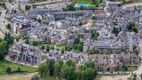
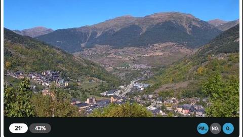
Catalonia's public broadcaster keeps this weather camera high on a hillside above Vielha. It looks across the valley of the Garonne: on the left, the houses of a village climb the slope; on the valley floor, the slate roofs of Vielha and Betren, the main road and some larger buildings; behind them, wooded mountainsides rise to bare ridges, with a side valley opening between them. It is a still image, not a video: the reload button brings the latest one it has sent.
It is the best quick check of the weather in the capital of Aran: whether cloud is down on the ridges, how much snow lies on the roofs after a storm, and whether the forests are green, gold or white.
Vielha from Vilac, looking south
Vilac is a small village on the slopes above Vielha, at about 1,050 m (3,440 ft), and this camera looks south from it. In the foreground are meadows and trees; the town of Vielha fills the bottom of the valley in the middle of the picture, and behind it rise the steep, forested mountains on the south side of Aran, with rocky summits on the skyline.
Because it faces the mountains that the Vielha tunnel runs under, it shows at a glance whether the high ground is clear, in cloud or under fresh snow. It comes through Windy as a time-lapse of the day, so you can scroll back to see how the weather has changed since the morning.
The upper Aran valley from Bagergue
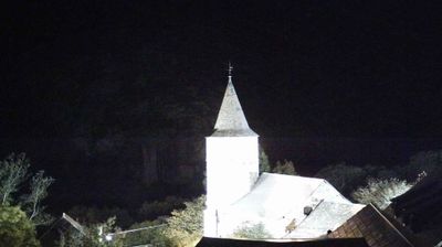
Bagergue, at 1,419 m (4,656 ft), is the highest village in the Val d'Aran, and this camera looks down the valley from just outside it. Green meadows and birch and beech woods fill the foreground; in the middle distance, the houses and church towers of the villages of the Naut Aran stand on the valley floor, and far behind, the high peaks of the Pyrenees close the view, sometimes already white when the valley is still green.
It is a good camera for seeing autumn colour and the first snow on the high summits, and in winter for judging how far down the valley the snow lies on the way to the Baqueira slopes. It comes through Windy as a time-lapse of the day.
The lake at the Colomèrs refuge
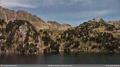
This camera stands at the Colomèrs refuge, at about 2,135 m (7,000 ft) in the Colomèrs cirque, on the edge of the Aigüestortes i Estany de Sant Maurici National Park. It looks across the dark water of the Estanh Major de Colomers to granite slopes dotted with pines and rocky ridges beyond. The refuge belongs to the Aran government and lies on the GR-11 and on the Carros de Foc round of the park's refuges.
For walkers it is the camera to check before the climb from the Banhs de Tredòs: whether the sky over the cirque is clear, whether cloud is coming in, and late in the season whether snow or ice has reached the lake. It comes through Windy as a time-lapse of the day.
An Atlantic valley in Catalonia
Because Aran drains north into France, it has an Atlantic climate: greener, wetter and snowier than the Catalan valleys to the south. It has its own language, Aranese, a form of Occitan that is official alongside Catalan and Spanish, and a self-government that goes back to 1313. Until the Vielha road tunnel opened in 1948, the only way to the rest of Spain was over the Bonaigua pass, at 2,072 m (6,798 ft), which snow closed for much of the winter. The pistes of Baqueira-Beret begin a short drive up the valley and have their own page under Ski Resorts.
When to watch Vielha
Vielha is one hour ahead of the UK and Ireland. Atlantic weather fronts reach Aran first, so cloud can sit on the ridges here while the rest of Catalonia is in sunshine, and the cameras are the quickest way to tell. Mornings are usually the clearest time of day. In winter, look for fresh snow on the roofs; in summer, for storm clouds over the high cameras.
Around Vielha
Up the valley lie Arties, Salardú and Bagergue, stone villages with Romanesque churches; Bagergue, at 1,419 m (4,656 ft), is the highest in Aran and one of the Most Beautiful Villages of Spain. Walkers head for the lakes of the Colomèrs cirque, on the edge of the Aigüestortes i Estany de Sant Maurici National Park, where the GR-11 trail crosses the Pyrenees. Downstream, the Garonne leaves Spain at Pont de Rei.
Visiting Vielha
The nearest airport with regular flights from the UK is Toulouse, about 104 miles (168 km) by road. Barcelona is about 196 miles (316 km) away, through the Vielha tunnel on the N-230. In winter, carry snow chains or fit winter tyres, and check the road before you set off.